My NYC Bike-cation
I recently got back from a vacation to the East Coast of the US. For two days during my trip, I biked around New York City and explored various neighborhoods, parks, and bridges.
In this post (my first that’s not about tech!), I want to share my routes and also some observations from the perspective of someone who has done most of their biking in the San Francisco Bay Area.
Logistics
New York has a massive bike share program, Citi Bike, with stations all over the city. These bikes are relatively cheap to rent ($15 / day), but they’re heavy and not designed for steep hills, so I decided to go a little more upscale and rent a nicer bike each day from a bike rental kiosk in Central Park.
The kiosk bikes were still not amazing as they were designed more for cruising than hardcore rides, but at least they had more gears, better brakes, and lighter frames.
Each day, I walked from my hotel in Times Square to the rental kiosk, paid $40 for a day-long rental, and then was off riding within a few minutes. Central Park, as implied by its name, is centrally located, so it was easy to go off in various directions based on the plan for the day.
Day 1: Manhattan
On the first day, I did Manhattan Island from end-to-end:
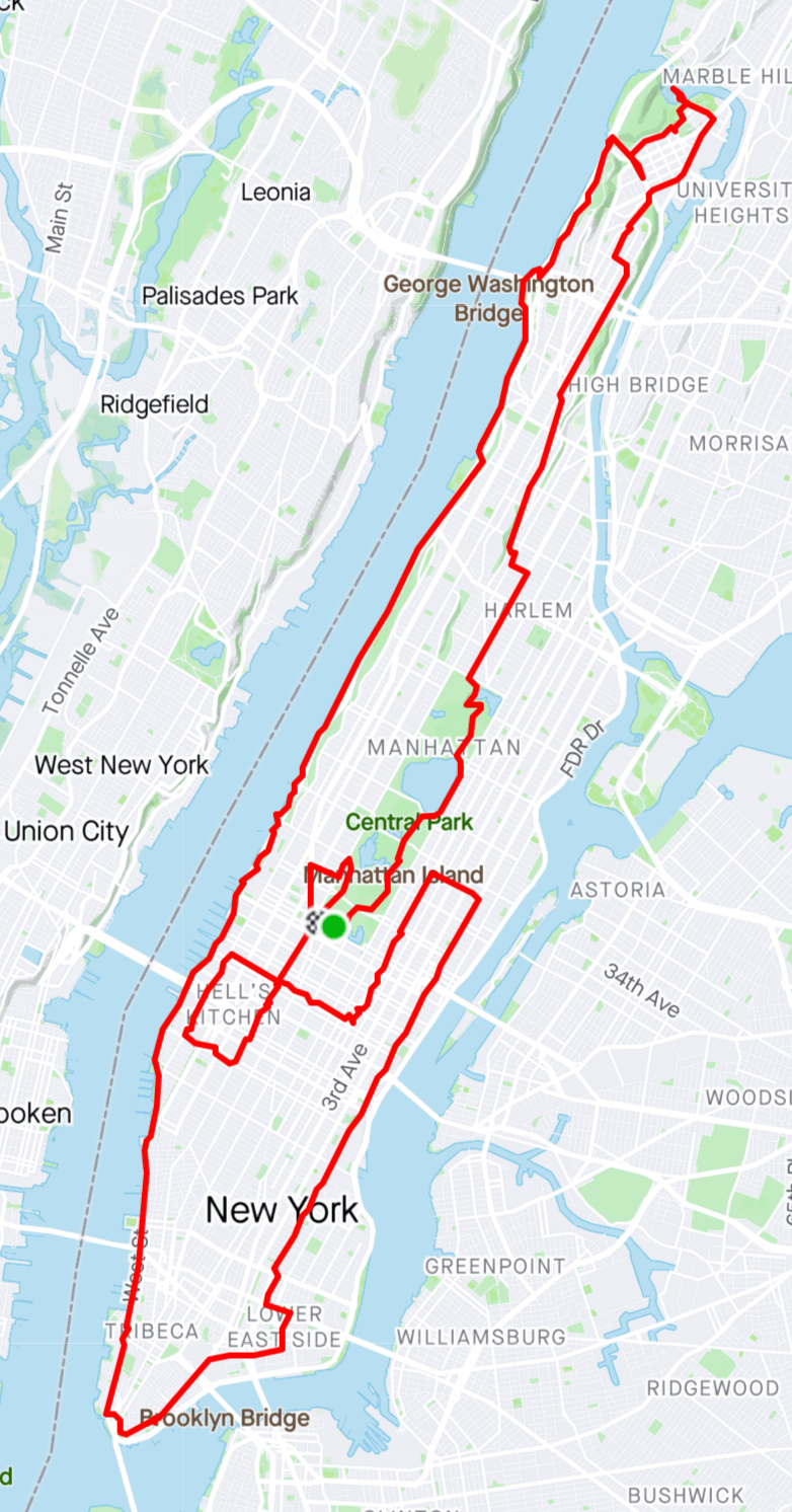
Net elevation gain: 1,086 feet.
See Strava for more details.
Starting in at the kiosk in the southwest corner of Central Park, I went up through the park then took local streets from the north side of the park to the upper tip of Manhattan. This took me through the neighborhoods of Harlem, Washington Heights, and Inwood, ending up at the beautiful Inwood Hill Park at the northwestern corner of the island.
I then took the Hudson River Greenway, a paved, off-street bike trail, down the entire west side of Manhattan to The Battery at the southern tip of the island.
Finally, I took local streets back up to midtown Manhattan, doing some loops among the high-rises of the Upper East Side and Midtown before turning my bike in at the end of the day.
Day 2: Brooklyn
On day two, I did a big loop through the Brooklyn Borough, bounded by some mileage in Queens and Manhattan:
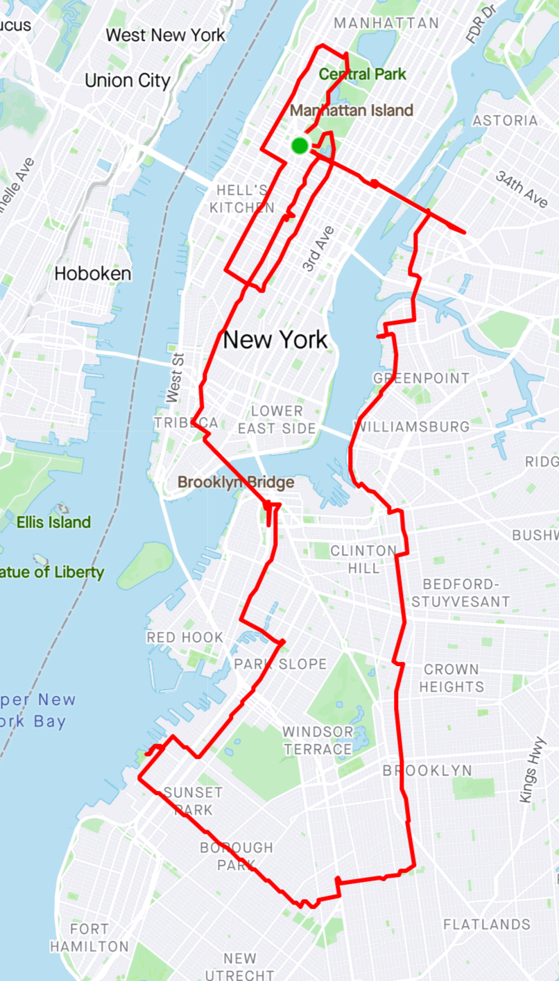
Net elevation gain: 1,086 feet.
See Strava for more details.
I started by going east across Midtown and then over the Queensboro Bridge into Queens. I then went south into Brooklyn, passing by the hip and expensive new housing developments along the riverfront in Greenpoint and Williamsburg.
I then cut inland and looped around some less gentrified areas of Brooklyn, including the neighborhoods of Crown Heights, Flatbush, Borough Park, and Sunset Park.
This was definitely the most interesting part of my ride. Far away from the touristy and yuppified parts of Manhattan, there was an incredible diversity of architecture, businesses, and people. Based on the specific location, the population varied from Orthodox Jews to Chinese immigrants, and the building stock from concrete high-rises to beautiful, suburban-like, single family homes.
In Sunset Park, I turned back north and ended up in Downtown Brooklyn. After a quick break, I crossed over the Brooklyn Bridge back into Manhattan, took local streets back up to Midtown, and then did some loops around Hell’s Kitchen and the Upper West Side before returning my bike.
Observations
Bike infrastructure has improved a lot
The last time I rode in New York City was in 2004. At the time, there were paths along the rivers, in the parks, and over the bridges, but most other areas of the city were a biking wasteland- street riding was really the realm of hardcore bike messengers and others not afraid to weave in and out of speeding taxis and perform other, death-defying stunts.
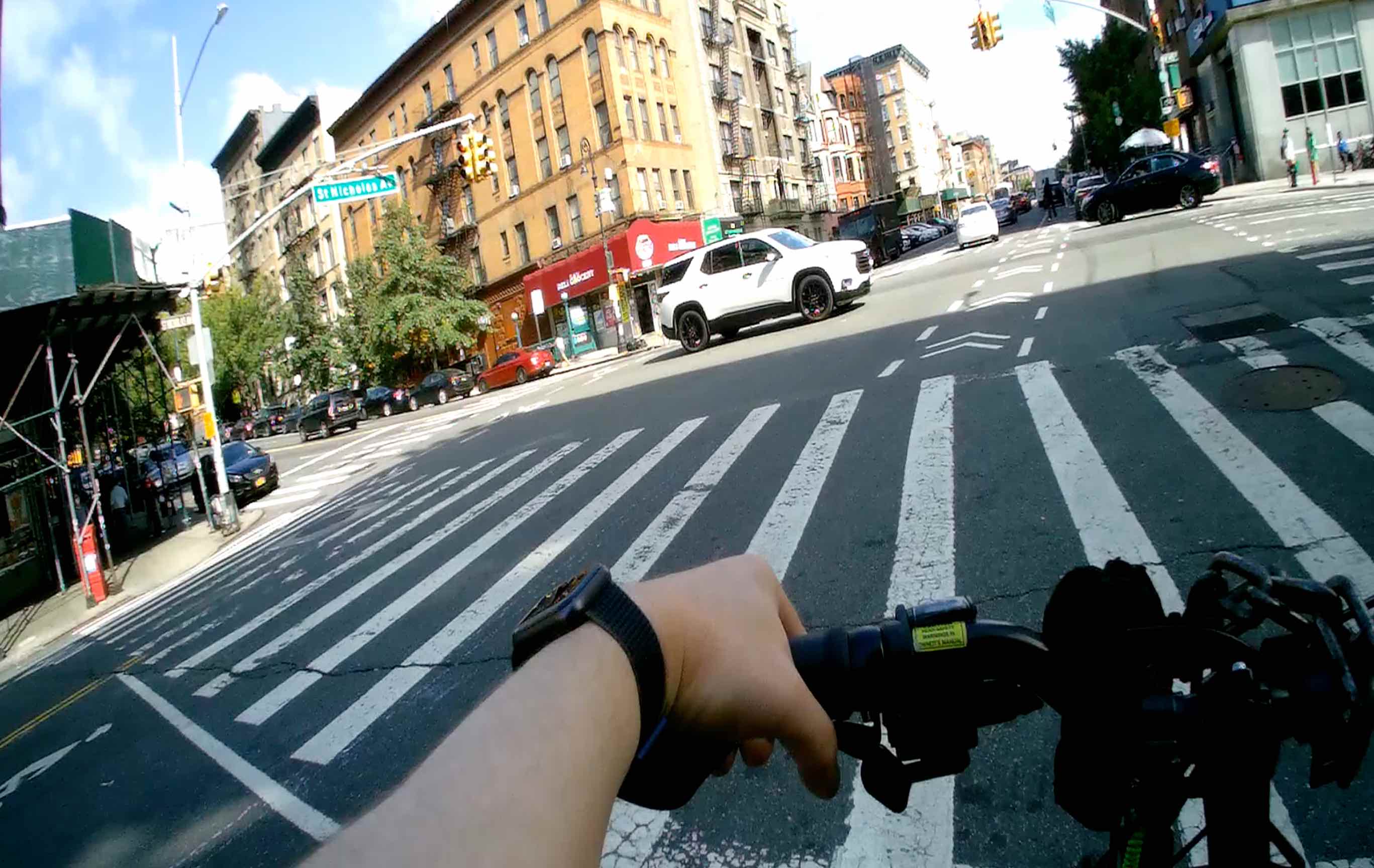
Now there is much improved, street-level bike infrastructure, particularly on some of the big, north/south avenues in Manhattan. Bikers often have an entire lane, and the street markings and traffic lights are designed so that turning drivers are forced to yield to bikes.
The lanes are definitely less dense and less protected outside of Lower and Midtown Manhattan. But at least they’re there and an improvement over riding in the middle of a busy street. Hopefully, the network will be expanded more in the future.
There are a ton of bikers
As a result of the improved infrastructure, there were a lot of bikers, particularly in Central Park and along the Hudson River in lower Manhattan. At times, I felt like I was in one of those giant, densely-packed racing groups in the Tour de France.
It was nice to see so many bikers (I’ve never seen so many anywhere else), but at the same time it felt a little confining. Clearly, there is a ton of demand for bike infrastructure, so the city should devote more space to bikes in these neighborhoods. Until then, I’d advise avoiding these areas at peak times unless you don’t mind crowds.
The bike routes in Google Maps are amazing
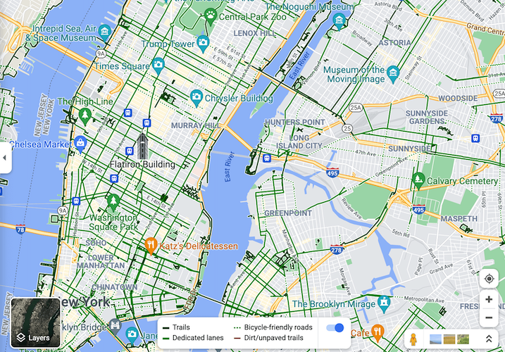
The bike route layer in Google Maps is absolutely amazing for New York City. Not only does it show which streets have bike lanes, but it also allows you to navigate through the road labyrinths that obscure bike path entrances, like the ones at the bases of the East River bridges.
I used Google Maps for planning my NYC routes, and I found zero inaccuracies while on the road. I’ve had similar experiences with the bike route layers in other US cities like San Francisco and Washington, DC. Google has done a great job here, and hopefully this coverage will expand to more cities around the world.
Bikers don’t follow traffic laws
Bikers in San Francisco will definitely roll through stop signs and do other, “minor” violations when it’s convenient. However, the amount of traffic law breaking I saw in NYC was just at a completely different level. Even at big intersections, many bikers would routinely sail through red lights as if they were yield signs. I also saw some fun behaviors I had never seen elsewhere before, like motorcycles driving on off-street bike paths (super dangerous!).
According to a friend of mine who bikes in NYC a lot, enforcement is pretty rare. However, the police will sometimes set up “stings” at high traffic places like outside Penn Station. Apparently, those efforts aren’t sufficient to improve adherence to the rules.
Non-protected bike lanes are routinely ignored by cars
Bikers weren’t the only ones violating traffic laws. In particular, the amount of disregard for bike lanes by cars was also above and beyond anything I had seen elsewhere. Non-protected lanes (i.e., the ones at the side of the road between the traffic and parking lanes), were routinely treated as loading zones and parking spots. In some neighborhoods, there were multiple obstructions per block, making the lanes themselves almost unusable.
As with bikers violating traffic laws, I saw zero enforcement of cars violating the rules. I guess New York is kind of just a free-for-all for both sides.
Conclusion
I had a ton of fun biking around New York City. There is definitely room for improvement in terms of infrastructure and enforcement, but the city has come a long, long way over the last 15 years and is now a super interesting and relatively safe place to ride.
The city is huge, and I only got to explore a small portion of it on this trip. On my next vacation, I want to go back and ride around more!